






RHDHV develops port forecasting software
Netherlands-headquartered Royal HaskoningDHV is developing geospatial economics simulation software to better forecast the impact of economic and infrastructure changes on ports.
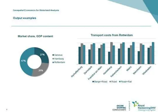
The engineering and project management consultancy aims to provide clients with an understanding of the hinterland of ports by accurately modelling and simulating the effect of transport cost, infrastructure and macro-economic developments on their competitive position and market share.
Xavier Schut, consultant at Royal HaskoningDHV, said: “They will be able to visualize scenarios on interactive maps/graphs and make better business decisions. This is an alternative to our conventional consulting approach which is labour intensive and qualitative.”
Instead of relying on conventional databases, the software works with geospatial data: data with GPS coordinates which users can draw and specify properties/contents of transport networks, country boundaries, cities, industry areas etc and perform calculations or statistics.
Multiple parties including ports, shipping lines, terminals, investors and freight forwarders can use the software.
Royal HaskoningDHV said it has received positive feedback from clients during testing and plans to start offering the new service at the end of the summer.
Related Articles
 EQUIPMENT
 EQUIPMENT