


Time to step up
While AIS has its benefits, ports need to move past simple identification, as Martin Rushmere explains
Efficiency and cargo throughput are at a stage where every large self-respecting port has to rely on a specialised vessel and docking tracking service, the best of which are able to process 50m real-time vessel positions daily.
Certainly in the US, this need for more detailed and a greater range of information has become more intense following the Deepwater Horizon fire in the Gulf of Mexico. Not that a vessel positioning system would have made any difference to the actual incident, but precise knowledge of vessel positions has become more urgent.
“The authorities everywhere are tightening up on every possible aspect of navigation and communication between ocean and shore,” says a consultant, “and are looking at safety and security of both fixed assets and shipping movements. No one wants any repeat of such an accident simply because there is not enough information between ship and shore. AIS is great for showing a vessel’s position and course, but more is needed. As the industry has repeatedly found, it’s better to bring in more advanced systems before the government steps in, which can lead to the wrong type of solution.”
The trend is for all-encompassing systems that go beyond accurate and simple vessel location, the core feature of Automatic Identification System. Demurrage, invoices and Bills of Lading are being offered, plus more detailed and updated information on arrivals and departures.
Equally important are legal and administrative requirements/rules and considerations, where previously disputable matters of fact are now being definitively resolved.
The information and display packages offered use AIS as a platform and there is little or no need for hardware or software.
Industry initiative
AIS itself came about from an industry initiative, when the IMO mandated in 2005 that every vessel over 300 tons had to be fitted with an automatic positioning reporting/communication service. Primarily intended to warn of collisions and approaches by other ships, its purpose has mushroomed to the point that “it’s no longer about showing points on a map,” says Dean Rosenburg, chief executive of PortVision (now part of Oceaneering International), “but providing ports with a business service.”
Most systems are modular, allowing ports to start with the most basic vessel location application and moving up to a whole suite of administrative, billing and communications functions.
Pavel Skournik, vice president of operations at Klein Systems, says: “The specific, actual time that a vessel passes a waypoint is shown and an e-mail is sent automatically to all interested parties. It’s totally transparent and impartial. If a port merely relies on the AIS information sent out by a ship or operating company, critical information might be left out – possibly deliberately.”
Jason Tieman, PortVision’s director of maritime solutions, says: “The information is also extremely useful in sorting out legal and contractual disputes. We have been asked to provide verified data in legal disputes, right down to the exact time that a vessel went through a lock. Distance accuracy is down to about 3 metres.”
So comprehensive is the data available that users can get information on tidal surges and wake damage on berthed vessels and facilities from passing ships, comparing changes with earlier situations.
Average information updates are every 30 seconds, but clients can change this according to circumstances, such as docking and maneuvering, so that more accurate results can be noted. PortVision has teamed up with Orbcomm to provide satellite GPS data.
Regulation cover
Built into the programmes are regulatory and contractual stipulations such as maximum berth and container dwell time, which will warn when penalties and/or demurrage are due. BIMCO’s Virtual Arrival clause is also catered for, permitting “a charterer to request an owner to adjust the speed of a voyage chartered vessel to arrival at a loading or discharging port at an agreed date and time. Like the Slow Steaming Clauses, any reduction in the vessel’s speed with the charterers’ agreement will not be considered a breach of the owners’ due dispatch obligations,” according to BIMCO.
“The port fills in the information in the relevant fields,” says Mr Rosenberg, “and the accuracy of the data is thus dependent on the information therein.”
Also, masters of ships sometimes make timestamp errors when reporting Notice of Readiness to enter port. “There’s no ill intent on the part of crews,” says Mr Rosenberg. “Ships have been at sea for a long time. Often the crews aren’t aware of the charter party conditions and the demurrage that can be payable, and want to make sure they are in line to get tug boat and pilot assistance. They don’t realise that a difference of a few hours in passing a sea buoy can lead to hundreds of thousands of dollars in demurrage.”
And the need for more precise positioning data is intensifying with the growing use of floating LNG, which “adds a new dimension that traders and supply chain managers will need to incorporate into their vessel tracking and related information management activities”, according to PortVision.
New apps being developed include information on locality and damage from lightning strikes.
Growing awareness among US maritime authorities of the capabilities of AIS-enhanced systems has led the Coast Guard and Coastal and Marine Operators (CAMO), together with PortVision, to develop an AIS application to monitor and warn vessels stopped near gas and liquids pipelines.
Over the last two decades there has been over $100m in property damage and over 25 fatalities associated with coastal and marine pipeline incidents.
Yet it seems that the authorities are still not fully up to speed. At a Congressional sub-committee hearing earlier this year, Mr Rosenberg said: “We know of no uniform enforcement or educational campaign by the US Coast Guard to ensure that carriers comply [with requirements for ships to transmit a strong, steady signal]. Some regional VTS offices are vigilant about compliance, while other regions have less active oversight.”
He chided the government for its culture of specifying completely new products when awarding federal contracts. “Commercial offerings like PortVision are often overlooked in favour of “re-inventing the wheel” through government-funded “build-versus-buy” initiatives. This “not invented here” culture can put up barriers to government adoption of proven and widely deployed commercial technology. It also prevents many Coast Guard and other government field personnel from operating as effectively as industry partners who have access to these tools.”
Lead time
The decision on opting for a customised tracking system is probably the most difficult for a port authority. Signing up, implementation and phasing in can take a couple of years and if found to be unnecessary will lead to accusations of money wasting from taxpayers on top of the waste of time and man-hours. On the other hand there is the risk that by choosing to rely on AIS and, possibly, a generic positioning information service, a port is neglecting safety.
“We hold strictly to Best Practices management and principles,” says Klein Systems’ Mr Skournik, “and will advise a port if we think the volume of traffic does not warrant it.”
San Diego, California has gone for a generic, universal platform, using marinetraffic.com. Tanya Castaneda, spokesperson, says the port is too small to warrant an individually tailored service.
A PortVision module is used to administer the Vessel Speed Reduction programme that encourages ships to keep to a 12 knot maximum speed (15 knots for cruise ships) within a 20 nm range.
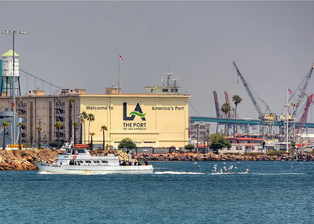
Los Angeles uses Klein Systems for billing and other administrative tasks, paying about $1.8m. The programme is also used by the wharfinger and port pilot divisions. About 40,000 transactions are covered, involving $500m in revenue.
Opening the port to cyber risks
The greater the reliance on automatic and electronic control and information, the greater the risk of data theft and cybercrime. The US General Accountability Office (GAO) has voiced concern that too little is being done to protect maritime computer systems from criminals and hackers, which has prompted the Department of Homeland Security to increase protection systems and find weak spots.
The GAO has also taken the Coast Guard to task. “A sector coordinating council for sharing information among non-federal stakeholders is no longer active, and the Coast Guard has not convinced stakeholders to re-establish it. Until the Coast Guard improves these mechanisms, maritime stakeholders in different locations are at greater risk of not being aware of, and thus not mitigating, cyber-based threats.”
One definite result has been the establishment of funding for cyber security under the port security grant programme administered by yet another government department, the Federal Emergency Management Agency. The GAO says that more needs to be done to guide ports through what the industry recognises as a labyrinth of processes.
Related Articles
 OPERATIONS
 OPERATIONS
 PRODUCTS & SERVICES