




Managing port vessel traffic using earth observation technology
ABPmer and BMT ARGOSS are working on a European Space Agency-funded project to provide earth observation-based monitoring services to support Vessel Traffic Management systems
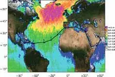
Port operators and shipping companies are subject to increasing levels of environmental legislation, which inherently increases their monitoring responsibilities. It is recognised that a key element in maintaining good environmental conditions within ports and coastal waters is to minimise the risk of accidents in areas under port authority control. Accordingly, in 2002, the European Community issued Directive 102/59/EC – establishing a Community vessel traffic monitoring and information system, which replaced the 1993 legislation for vessel traffic monitoring. The most critical areas recognized by the maritime community are the coastal waters, and in particular the port approaches, where the situation is often critical, and conditions can be highly variable in space and time and therefore unpredictable. As a subsidiary of Associated British Ports, ABPmer is frequently required to support its parent company by providing data, geoinformation and expert advice in response to environmental or operational monitoring requirements. At present, little use is made of satellite based earth observation (EO) for these activities and current service capabilities are at a very preliminary development stage. In 2004, ABPmer were involved in a pilot study to determine the extent to which earth observation data could fulfill the geoinformation requirements of port and harbour authorities. The study concluded that few port operating authorities were aware of the capabilities of EO data and that there were significant blockages preventing the wider uptake of these data streams. Of the different EO data platforms reviewed during the study, Ocean Colour, High Resolution Optical Imaging and Synthetic Aperture Radar (SAR) were found to be the most suited to port applications. The study also identified a number of potential applications for satellite data including:
• Oil spill monitoring
• Measurement of environmental parameters such as suspended sediment concentrations and chlorophyll to reduce the impacts of dredging operations; and
• Provision of wave and current data to assist in piloting operations. ABPmer and BMT ARGOSS are currently being funded by the European Space Agency to develop and deliver earth observation based monitoring services to support Vessel Traffic Management at a number of ports within the UK and Europe. ABPmer are responsible for managing the integration of EO based data supplied by BMT ARGOSS with in situ data from End Users and for developing a suitable platform for service delivery. The key elements of the POCAHONTAZ (Port and Coastal High Resolution Traffic Safety Zones) service are:
• To support vessels as they travel between ports;
• To support Vessel Traffic Services in managing port safety;
• To characterise (and thereby reduce) the risk of accidents to shipping both within the port environment and between ports. Based on an initial review of information requirements within port management services, it is anticipated that the proposed service will integrate the following data streams:
• Metocean forecasting;
• Integration of near real time EO data with in situ measurements to improve local and regional forecasts of metocean conditions;
• Automatic Identification Service infrastructure;
• Marine spatial planning tools;
• Port usage/berthing statistics.
During the coming 12 months, a series of service trials will be carried out in order to test the suitability of the products and services being developed. Humber Estuary Services will act as a key customer for the services during the development phase. Humber Estuary Services (HES) is part of Associated British Ports (ABP) the UK’s biggest ports group, which owns and operates 21 ports, including the four Humber Ports of Grimsby, Immingham, Hull and Goole. Vessel Traffic Services (VTS) Humber, which is located at Spurn Point, operates a 24-hour service for all river users. Its major function is to monitor and regulate navigation of those parts of the Humber Estuary and Rivers Ouse and Trent within the jurisdiction of the Harbour Master, Humber.
In addition to the Humber Estuary Services, the Port Authorities for Groningen, Antwerp and Shannon have expressed a particular interest in extending their monitoring and forecasting capabilities outside the port environs. The main reason why these extended port safety zones do not currently exist is that the cost of managing shipping risk over a larger area is simply too expensive. A key element of the service trials will therefore be to determine how the data products and delivery infrastructure may be adapted in response to each user’s specific requirements whilst remaining commercially viable. Although still at a very preliminary stage in development, it is likely that the Service Trials will address the following issues, which have been raised by the key user organisations:
• Delivery of high resolution wave and current data to assist in the management of vessels awaiting entry into the various ports and integration of this data stream into the existing VTS infrastructure;
• Provision of wave, current and water level forecasts to ships travelling between ports; and
• A shipping risk assessment assuming a theoretical worst case scenario (input to disaster mitigation plan), including for example, extreme weather, congestion in port approaches, or a pollution incident such as oil spillage.
Following the delivery of the Service Trials and their subsequent evaluation by the User Organisations, services or products that do not meet a minimum performance standard will be rejected. The remaining services will then be revised and upgraded in preparation for the final activity in the ESA funded study which will be to develop a commercial service roll-out strategy. This will include a firm schedule for delivering the service upgrades and will mainly focus on mechanisms for expansion and operational delivery.
Related Articles
 ALTERNATIVE FUELS GREENPORT