



Tracking ships from port to port
Is a pan-European vessel monitoring system on the cards? Patrik Wheater investigates
Could the recent installation of national vessel traffic management information systems (VTMIS) in Malta and the Republic of Cyprus lead to a pan-Europe system in which all vessel traffic data is accessed and shared by nation states? Chris Loizou, managing director of Transas Mediterranean, certainly thinks so.
He believes that the European Union intends to establish a central vessel management centre into which national data centres will feed the vital statistics from vessels navigating their waters. Data relating to a vessel’s location, time of arrival, and cargo, will then be distributed to other EU member states. So, if a vessel leaves the Port of Rotterdam, for example, then transits the English Channel, the west coast of France and beyond, vessel data will be passed from VTMIS centre to VTMIS centre, via 500 base stations dotted around the continental coastline.
This scenario would certainly meet Directive 2002/59/EC which aims to establish a vessel traffic monitoring and information system “with a view to enhancing the safety and efficiency of maritime traffic, improving the response of authorities to incidents, accidents or potentially dangerous situations at sea, including search and rescue operations, and contributing to a better prevention and detection of pollution by ship”.
As far as the National VTMIS for the Republic of Cyprus is concerned, the equipment, installation and commissioning was funded under the INTERREG III/A programme, a Community initiative financed through the European Regional Development Fund (ERDF), which aims to stimulate interregional cooperation.
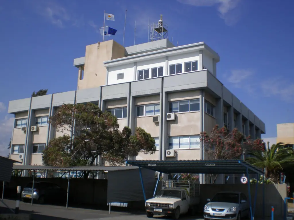
The Transas-supplied system consists of three control centres with a total of five operator positions; the coastal VTMIS is located within the Department of Merchant Shipping (DMS) in Limassol, a port vessel traffic system at Limassol Port and another at Larnaka Port.
In terms of equipment the Cyprus VTMIS is extensive and includes four high performance coastal surveillance shore-based radars and seven AIS base stations, among other hi-tech components.
But what is particularly interesting, perhaps offering a foretaste of how nation states might use the data, is the fact that the remote terminals have been commissioned to the Limassol and Larnaka Marine Police, the Joint Rescue and Coordination Centre and the Coastal Radar System Control Centre.
A Marine Pollution Control Station has also been installed at DMS Headquarters and Transas has successfully integrated the system to EMSA SafeSeaNet, an EU initiative that provides a means of communication between the various maritime authorities at local and regional level.
The national VTMIS has also been integrated with the Cyprus Port Authority database, the Malta VTMIS (commissioned in 2006) and the EMSA MEDAIS, which collects, stores and distributes data acquired from the various national AIS stations throughout the Mediterranean.
“The East Mediterranean region is a very critical area, especially around the Suez Canal. The idea has been to link the monitoring of vessel traffic in the region and exchange that data with the SafetyNET interface,” explains Mr Loizou. Through this project, Cyprus [and Malta] is leading by example towards the integration of maritime authorities and the adaptation of port systems to the demands of international shipping and trade.
In time, believes Mr Loizou, VTMIS will provide web-based services with varying user-access levels where ship operators, government agencies and departments can, having inputted their password and IDs, log on to a service within the network to access ship data. Different levels of access would be managed by a central authority.
“There is huge scope for these national VTMIS systems,” he says. “And more and more national centres are being considered,” divulges Mr Loizou, who is currently working on four similar bids.
The next countries to have in place a national VTMIS will be Croatia, Italy and Portugal.
SAAB TransponderTech, the Sweden-based supplier of vessel traffic management and AIS solutions, for instance, has been awarded a contract to supply its CoastWatch VTMIS to Croatia for the monitoring and surveillance of maritime traffic outside the Croatian coast and its major harbours and ports.
As part of this undisclosed European Union-funded project, probably under the 2002 Directive, ten advanced radar sensors will also be delivered, from Terma AS. AIS data will then be integrated into the system which comprises one national control centre, three regional and eight local control centres. AIS base stations from CNS Systems will also be supplied to cover the complete Croatian coastline from Labin down to Dubrovnik. This will be integrated into the existing national AIS management system and then the complete network of AIS base stations will integrate data from the VTS facilities.
Equipment will be delivered during 2009 and commissioned during 2010.
Meanwhile, the integration of various vessel monitoring technologies is the central tenet of the ¢20m ($14.7m) European Union-funded MarNIS project, the objective of which is to develop one operator-facing system. The technology focus includes:
- AIS (Automatic Identification System);
- LRIT (Long Range Identification and Tracking);
- WMS (Web Map Service);
- Synthetic Aperture Radar (satellite based)/Side-looking;
- and Airborne Radar/Space AIS.
Norway’s Kongsberg Norcontrol IT is playing a key role in this project and its C-Scope operator client has been an integral element, providing the basis for the VTS operator interface for both research and development and during live demos in Italy and Portugal.
For instance, in Genoa, Italy, during two final MarNIS demonstrations in October last year, the focus was on Maritime Operational Services (MOS), a new concept proposed by MarNIS where services like coastal Vessel Traffic Services, Search and Rescue, and Pollution Prevention are combined under one roof using one information system. MOS integrates information from numerous other systems that can be located internal or external to the MOS organisation.
This information might include: dynamical risk values per vessel, based on type of ship, cargo, age and flag of ship, weather and sea state info, traffic info, distance from shore; satellite based or aircraft based images of oil spills; and Long Range Identification and Tracking (LRIT) and space AIS.
The focus for the final MarNIS demonstration in Lisbon moved to Vessel Traffic Management in the port environment and one of the primary concepts demonstrated was sharing this information. This included, among other aspects, sharing traditionally shielded/closed VTS information with external systems and organisations such as pilots, police and customs; sharing AIS data from the base stations or network used by VTS; proposed approach routes for different types of vessels; and port terminal facilities, like location, bollard types, and cranes.
The project demonstrations are thought to herald a new era for VTS and some of the technology Kongsberg Norcontrol developed as part of the project is already in use. A C-Scope installation is in place at Vardø, Northern Norway, which is the first in the world to feature full integration with a Geographic Information System.
Kongsberg Norcontrol IT President Inge Flaten said in the February edition of the company’s in-house newsletter: “With Vardø as the forerunner, proving the performance of C-Scope, we are ready to implement this new functionality in other VTS installations in Europe and around the world, whether they are already running C-Scope or are ready to make the change to the cutting edge of VTS.”
Related Articles
 EQUIPMENT
 EQUIPMENT